Elmwood Trails

Description
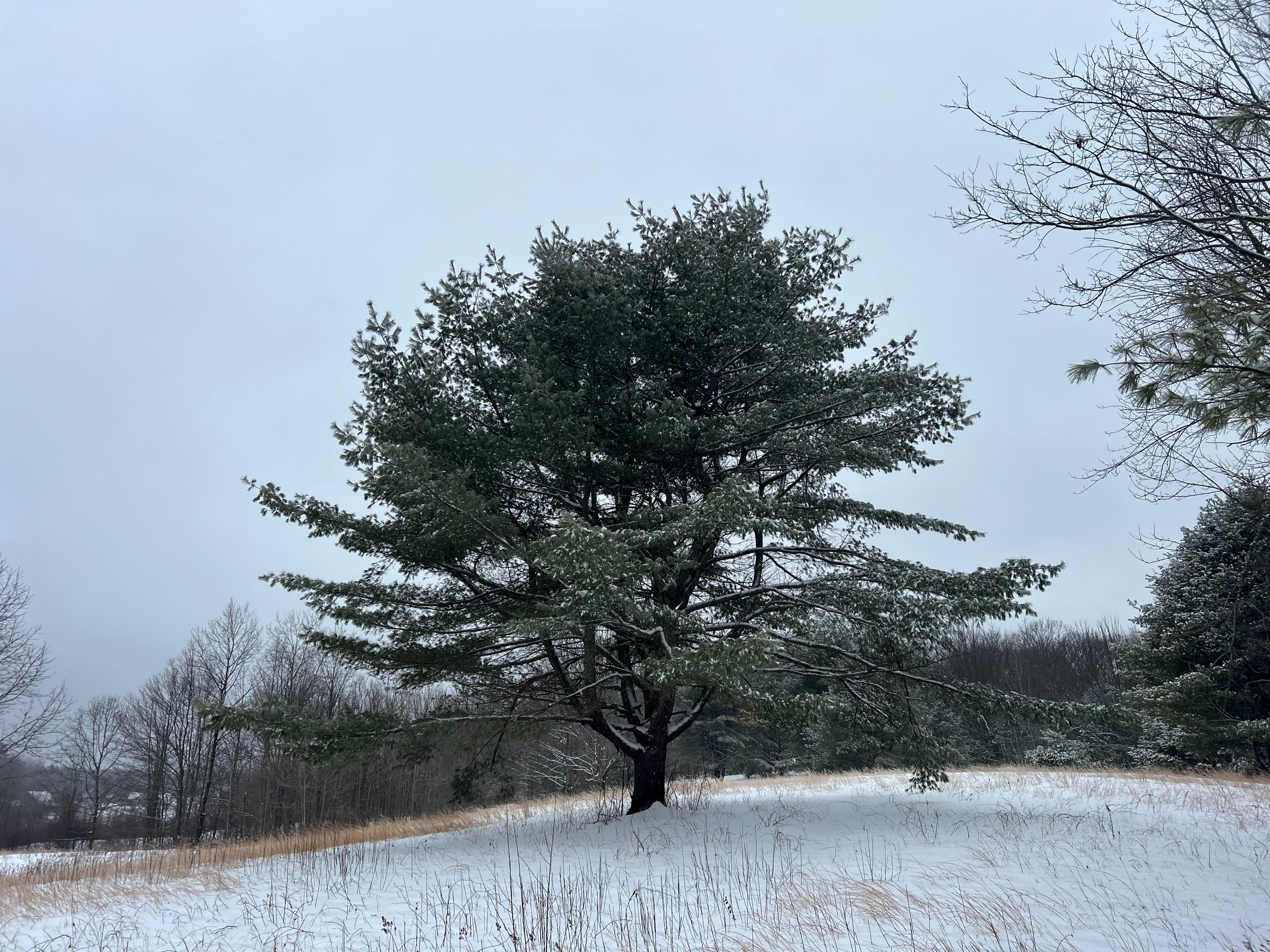
Elmwood Trails is a 2-mile trail that parallels Chandler Brook, meandering through peaceful hemlock woodlands and a grassland meadow. The trail consists of a series of trail easements across four private landowner properties, combined with state and Royal River Conservation Trust land. The path is narrow and includes bog bridges, rocks, and roots.
This trail is part of the Bradbury-Pineland Corridor – a network of trails traversing state-owned land, powerline rights-of-way, and other trails that connect Bradbury Mountain State Park and eventually the Pineland Public Reserve Land. Elmwood Trails also connects to the Town of Pownal's Elmwood Woodlot, on which RRCT holds a conservation easement.
Elmwood Road Trailhead: 819 Elmwood Road, Pownal
Sweetser Road Trailhead: 102 Sweetser Road, Pownal
State's Parking Lot: 500 Lawrence Road, Pownal
2.0 miles


More information
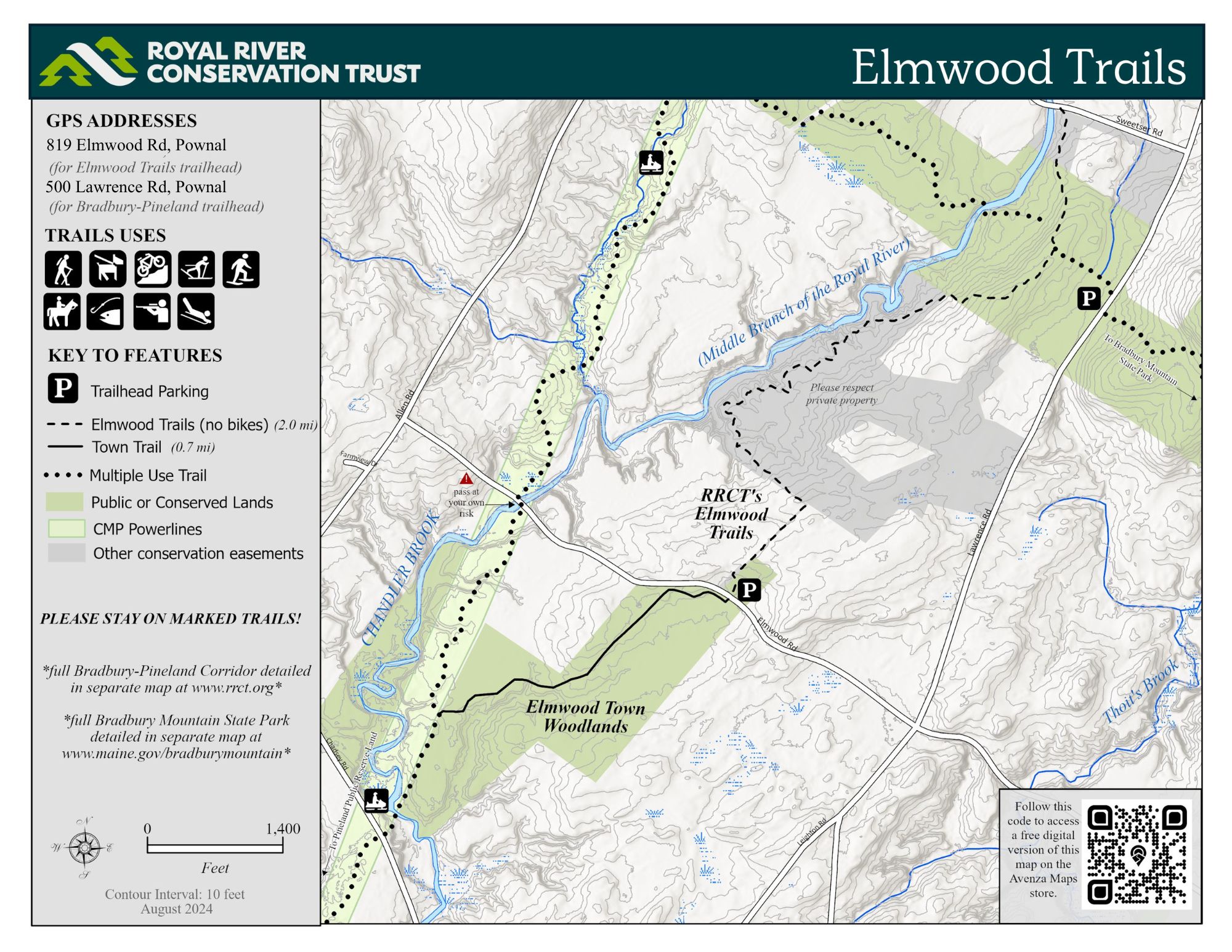
South of RRCT’s trailhead parking lot at 819 Elmwood Road is the Town of Pownal Elmwood woodlot. The woodlot's primary trail begins at Elmwood Road and later connects to the CMP powerline and crosses where it by bridge over Chandler Brook.
Access to the banks of Chandler Brook is available:
- On state-owned land (“the Corridor”) at and below the Corridor trail bridge;
- Half-way between Elmwood Road and Sweetser Road (approximately 1 mile from either trail entrance) at the trail stairs and stone steps; and
- On the shoulders and abutments of Sweetser Road at the Sweetser Road bridge.
Elmwood Trails is a 2-mile trail that parallels Chandler Brook, meandering through peaceful hemlock woodlands and a grassland meadow. The trail consists of a series of trail easements across four private landowner properties combined with state and Royal River Conservation Trust land. The path is narrow and includes bog bridges, rocks, roots, and wet areas. It is not accessible to users with mobility challenges. Elmwood Trails intersects with the Bradbury-Pineland Corridor Trails, which further connects trail users to Bradbury Mountain State Park, CMP Corridor Trails, and eventually Pineland Public Reserve Land.
View this trail on:
Parking is available at a 14-car parking lot on Elmwood Road near a sharp curve (GPS Address: 819 Elmwood Road) or on the shoulder of Sweetser Road (GPS Address: 102 Sweetser Rd) in Pownal.
The state’s parking lot on Lawrence Road (GPS Address: 500 Lawrence Road) provides the best year-round off-road paved parking for trails that connect to Elmwood Trails.
- On-trail public access welcome - hiking, trail running, dog walking, snowshoeing, backcountry skiing, equestrian use, birdwatching, and fishing on Chandler Brook.
- Dogs are welcome on a leash or under strict voice control, leaving no trace of their visit.
- Bikes and motorized vehicles are prohibited.
- No camping, overnight parking, fires, or smoking.
- Please respect all trail postings. The land on both sides of the path is private in most locations.
- Hunting may be allowed on private abutting land. During hunting season, all trail users should wear blaze orange.
Elmwood Trails
Elmwood Trails is a 2-mile trail that parallels Chandler Brook, meandering through peaceful hemlock woodlands and a grassland meadow. The trail consists of a series of trail easements across four private landowner properties, combined with state and Royal River Conservation Trust land. The path is narrow and includes bog bridges, rocks, and roots.
This trail is part of the Bradbury-Pineland Corridor – a network of trails traversing state-owned land, powerline rights-of-way, and other trails that connect Bradbury Mountain State Park and eventually the Pineland Public Reserve Land. Elmwood Trails also connects to the Town of Pownal's Elmwood Woodlot, on which RRCT holds a conservation easement.